Super El Niño 2026: Is This Normal, or Is This Biblical?
As a Historic El Niño Intensifies and Super Typhoon Bavi Devastates Rota, Jesus’ Words About “Birth Pangs” Are Worth a Second Look
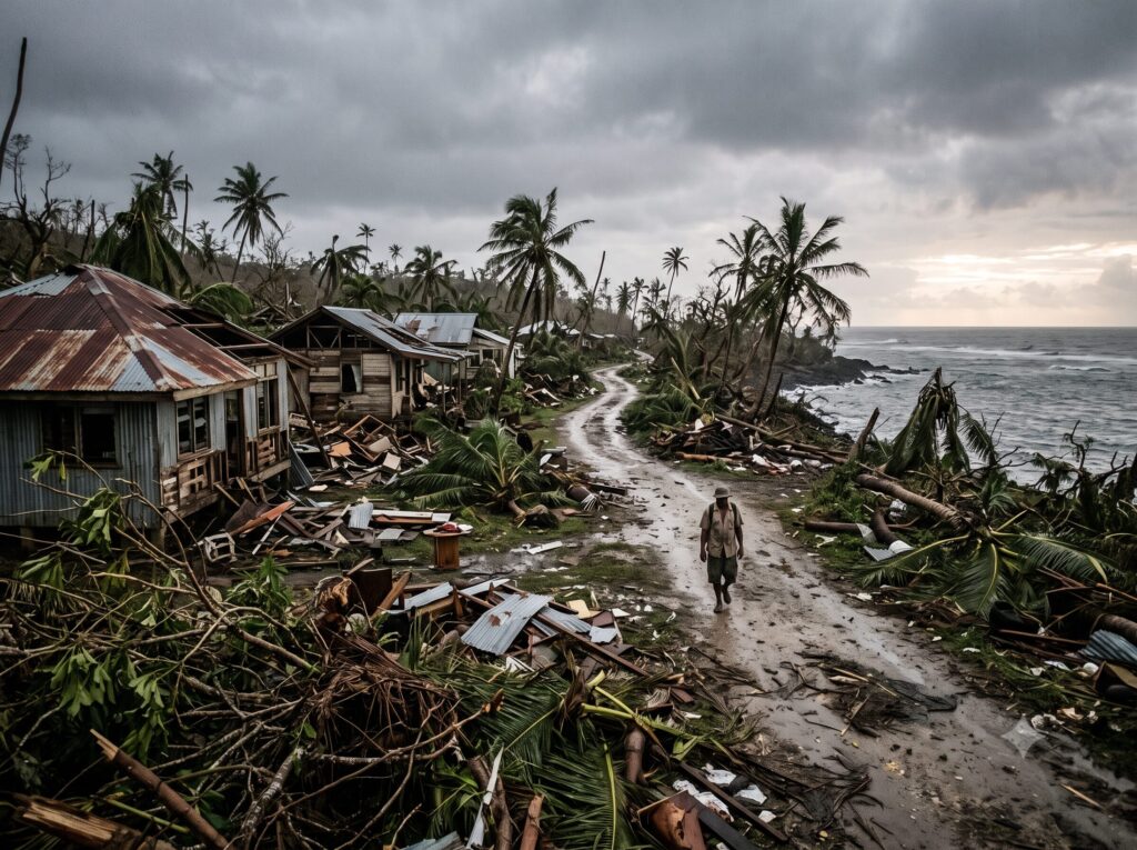
Super El Niño 2026 is shaping up to be one of the strongest on record — and the same week forecasters confirmed it, Super Typhoon Bavi tore across the tiny Pacific island of Rota as a Category 5-equivalent storm, its sustained winds reaching 180 miles per hour. Rota’s mayor, Aubry Hocog, didn’t mince words afterward: “Our public facilities, our government, our assets, our private residences and then even our port of entries — our airport and seaport — they have undergone damage.” Every aspect of the island, she said, had been touched.
Mercifully, no lives were lost. But thousands of residents were left without power or running water, and more than half of Rota’s structures sustained damage. And here’s what makes this story bigger than one storm: in the very same week, climate scientists at NOAA, the World Meteorological Organization, and Columbia Climate School confirmed that the El Niño pattern behind 2026’s weather volatility is intensifying faster than expected — so much so that one ECMWF forecaster told phys.org it would be “a very, very big surprise” if this event failed to break records.
Is this just an unusually rough week of weather? Or is it something Jesus told us to watch for? Let’s look at the facts first, then see how they fit into the bigger picture.
What’s Actually Happening?
El Niño conditions officially developed in the tropical Pacific in June 2026. By June 11, NOAA’s Climate Prediction Center had issued an El Niño Advisory, reporting the Niño-3.4 index — the standard measure of central Pacific warming — at +0.7°C, with the eastern Pacific index even warmer at +2.1°C. The WMO estimated an 80% likelihood of El Niño conditions persisting through August 2026, with better than 90% odds it would continue into the fall.
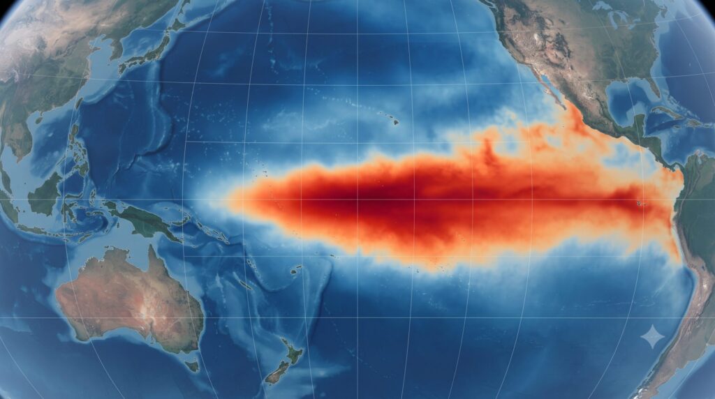
Then, on July 7, the story shifted. Newsweek reported that “a developing El Niño climate pattern is now forecast to become significantly stronger than previously expected, with some forecasters warning it could be one of the most intense events on record.” Columbia Climate School’s State of the Planet confirmed the same day that climate models show the pattern “rapidly strengthening.”
Twenty-four hours before that report published, Super Typhoon Bavi made its direct hit on Rota. The National Weather Service had warned residents to expect catastrophic winds as the eyewall passed over the island — and that’s almost exactly what happened, with gusts reportedly reaching 215 mph. Guam, Tinian, and Saipan all felt the storm’s effects as well.
Is Super El Niño 2026 Normal?
Let’s be fair to the skeptics here, because they have a point worth acknowledging: El Niño is not some rare or mysterious phenomenon. It’s a well-documented, naturally recurring climate pattern that shows up every two to seven years. If you’ve lived through a few decades of weather, you’ve lived through El Niño winters before — the extra rain, the wild jet stream, the memes about it being someone’s fault.
So what’s different this time? It’s not that El Niño exists. It’s the language coming from the forecasters themselves. NOAA didn’t just say “El Niño is here” — they flagged high confidence in rapid intensification. Newsweek didn’t just report a seasonal pattern — they reported forecasters using words like “one of the most intense events on record.” That’s not hype from a prophecy blog; that’s the tone coming out of NOAA’s Climate Prediction Center and Columbia University’s climate scientists in the same week a Category 5-equivalent typhoon flattened a US territory.
One unusually strong storm doesn’t prove anything by itself. But an unusually strong storm landing in the same week that mainstream climate scientists are surprised by the pace of an intensifying Super El Niño 2026 — that’s the kind of convergence worth paying attention to.
What Jesus Said
In Matthew 24, Jesus’ disciples asked Him what signs would precede the end of the age. Part of His answer:
“And there shall be famines, and pestilences, and earthquakes, in divers places. All these are the beginning of sorrows.” (Matthew 24:7-8, KJV)
The Greek word behind “sorrows” is the word for labor pains. Jesus wasn’t describing a single dramatic event that announces the end is near. He was describing something that starts small, then increases in frequency and intensity over time — exactly the way contractions work before a birth. One contraction doesn’t mean labor has started. A pattern of contractions, getting closer together and more intense, does.

Luke’s account adds detail: “And great earthquakes shall be in divers places, and famines, and pestilences; and fearful sights, and great signs shall there be from heaven.” (Luke 21:11, KJV) Note the phrase “in divers places” — not one location, but many, showing up in different forms and different regions.
Here’s my read on this, and I want to be careful with how I say it: I don’t think Typhoon Bavi or this Super El Niño 2026 pattern proves anything on its own. What I do think is worth noticing is the pattern itself — extreme weather events showing up with increasing frequency, in different forms, in different places, right alongside forecasters’ own surprise at the pace of change. That fits the shape of what Jesus described. It doesn’t prove the timeline. It’s evidence worth adding to the pile.
I’ll also say plainly: mainstream climate science has its own explanation for El Niño’s behavior, rooted in ocean-atmosphere cycles and long-term ocean warming trends. That explanation isn’t wrong, and it isn’t in conflict with a providential view either — God can work through natural processes He set in motion at creation. Some things about the timing and meaning of these events are simply sealed until God chooses to reveal them. I’m not claiming certainty here. I’m noticing a pattern and holding it with open hands.
This Is Not Isolated
What makes this week notable isn’t Bavi alone, and it isn’t the Super El Niño 2026 forecast alone — it’s that both landed in the same seven-day window, each independently confirmed by different scientific bodies with no coordination between them. That’s the nature of “birth pangs”: not one dramatic sign, but a clustering of disruption that keeps showing up closer together. Keep an eye on both of these stories in the weeks ahead — Convergence Watch will track them as they develop.
Why This Matters
If you’re a believer, none of this should produce panic. It should produce alertness. Jesus told us these things would happen before He returns, and watching them unfold in real time is evidence that His words are trustworthy — which means His promises about hope and restoration are just as trustworthy. That’s reason to pray, to stay grounded in Scripture, and to live with readiness rather than fear.

If you’re curious but not sure what you believe, consider this: prophecy that can be checked against real, dated, sourced events is worth investigating rather than dismissing. That’s the whole point of Discerning the Times — building proof, not asking for blind faith.
And if you’re skeptical of all this — good. Stay skeptical. Check the sources yourself. Pattern recognition isn’t panic; it’s discernment. Nobody, including Samuel, knows the day or hour. But Jesus told us to watch, and watching is exactly what we’re doing.
Related: 2026 El Niño Heat Dome: NOAA’s Record Forecast and Super Typhoon Bavi and the El Niño Convergence.
Related reading: Atmospheric River Chile.
Ready to Look Up?
Two extreme weather stories. One week. A pattern worth watching, not a date to circle on a calendar. That’s the posture Scripture calls us to — alert, not anxious; convicted, not certain about things God hasn’t revealed.
Ready to Look Up? Watch the Message of Hope.
Watching with you, —Samuel
SOURCES & CITATIONS
NOAA Climate Prediction Center, “ENSO Diagnostic Discussion,” June 11, 2026 — https://www.cpc.ncep.noaa.gov/products/analysis_monitoring/enso_advisory/ensodisc.shtml
NOAA News Release, “El Nino forms, expected to strengthen, say NOAA forecasters,” June 11, 2026 — https://www.noaa.gov/news-release/el-nino-forms-expected-to-strengthen-say-noaa-forecasters
World Meteorological Organization, “WMO: Prepare for El Niño,” June 2, 2026 — https://wmo.int/news/media-centre/wmo-prepare-el-nino
Phys.org (AFP), “El Nino set to be ‘strong,’ UN warns,” July 4, 2026 — https://phys.org/news/2026-07-el-nino-strong.html Phys.org (AFP),
“This year’s El Nino likely to become record-breaker: Top expert,” July 7, 2026 — https://phys.org/news/2026-07-year-el-nino-breaker-expert.html
Columbia Climate School, State of the Planet, “Climate Models Show El Niño Is Rapidly Strengthening,” July 7, 2026 — https://news.climate.columbia.edu/2026/07/07/climate-models-show-el-nino-is-rapidly-strengthening/
Newsweek, “Super El Niño Forecast Strengthens—What It Could Mean for US Winter,” July 7, 2026 — https://www.newsweek.com/super-el-nino-forecast-strengthens-what-it-could-mean-for-us-winter-12164998
Stars and Stripes, “‘Every aspect’ of Pacific island damaged or destroyed by Super Typhoon Bavi,” July 7, 2026 — https://www.stripes.com/theaters/asia_pacific/2026-07-07/%E2%80%9Cevery-aspect%E2%80%9D-of-pacific-island-damaged-or-destroyed-by-super-typhoon-bavi-22198204.html
RNZ Pacific, “More than half of Rota’s structures damaged as recovery begins after Bavi,” July 8, 2026 — https://www.rnz.co.nz/news/pacific/685556/more-than-half-of-rota-s-structures-damaged-as-recovery-begins-after-bavi
Isla Public Media (KPRG), “Bavi’s 180 mph winds rip apart Rota Mayor’s Office,” July 6, 2026 — https://www.islapublic.org/news/2026-07-06/bavis-180-mph-winds-rip-apart-rota-mayors-office